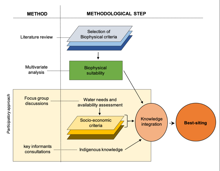
Sand dams are simple and effective structures built across ephemeral riverbeds in arid/semi-arid regions to harvest water within sand pores and increase water availability and quality for rural communities. The complex morphological, hydrological, social and economic conditions that make sand dams a beneficial tool for water resilience are largely influenced by the siting phase. Proper location of a sand dam can reduce community’s travel time to water points, reduce water conflicts and increase food security through expansion of irrigated agriculture. On the other hand, a misplacement of sand dams can, at worst, increase disparities in water access and increase local conflicts. To approach a viable siting of sand dams, most projects are developed and delivered with the community through a bottom-up approach. However, in case of large-scale project, remote sensing and biophysical analysis are the dominant approach, leaving the socio-economic component at the margins of the siting strategy and eventually affecting the benefits to local communities. In this paper, we propose a large-scale participatory methodology to sand dams siting, which draws on mixed-methods connecting the conventional top-down biophysical analysis with bottom-up participatory research. We first describe the generic approach developed for sand dams siting in Namibe, a semi-arid region of South-west of Angola, then we draw on our case to propose a generic approach to large-scale participatory siting beyond Namibe.